Labour Land Grab-The Facts
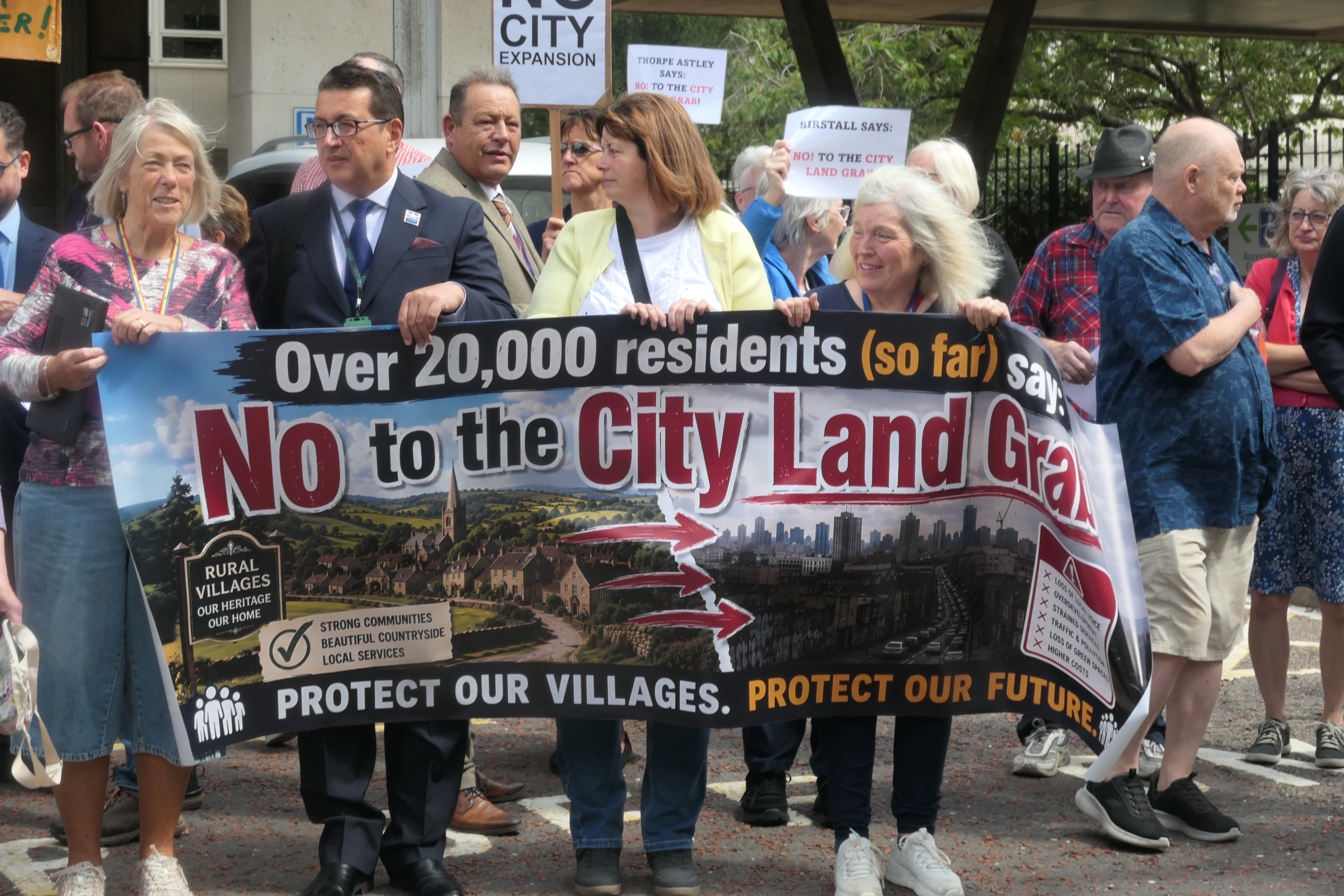
In July 2026, the Government confirmed that Leicester’s boundaries will expand for the first time in decades. Rather than keeping the city and county as separate authorities with unchanged borders, it decided to create two new unitary councils from 1 April 2028.
The formal announcement was made by Steve Reed MP, Secretary of State for Housing, Communities and Local Government, in a Written Ministerial Statement to Parliament on 16 July 2026.
The new structure will be:
- A unitary council covering Leicester, Oadby & Wigston, and parts of Blaby, Charnwood and Harborough.
- A second unitary council covering the remainder of Leicestershire together with Rutland.
Leicester City Council argued that:
- the city’s boundaries were largely fixed around 100 years ago;
- much of the urban area has expanded beyond those boundaries;
- Leicester has become one of England’s most tightly constrained major cities;
- expanding the boundary would better reflect where people live and work and provide land for future growth.
Leicestershire County Council initially opposed the city’s preferred expansion and proposed a different model with no boundary change to Leicester. Its focus was on creating a large county-based unitary authority.
After the Government made its decision in July 2026, the County Council accepted the outcome and began working jointly with the other councils to implement the changes by 2028.
For residents in the areas transferring into Leicester this means
- council tax will eventually be paid to a different authority;
- planning decisions will be made by the new Leicester unitary council;
- highways, social care, education and waste services will all be provided by the same council instead of being split between county and district councils;
- the changes will not take effect until April 2028, although elections for the new authorities are expected in May 2027.
This is particularly significant for large strategic developments around the city’s edge, including areas south and east of Leicester. Land that was previously administered by district councils may fall within the expanded Leicester authority, giving the city greater influence over long-term planning and infrastructure. The Government believes the new structure will better support housing growth, transport investment and economic development over long-term planning and infrastructure.
This will determine who ultimately becomes the planning authority for the 900 home south of the A47 at Bushby and the 4,000-homes South of Gartree Road/Stoughton development, these governance changes are likely to affect parts of those schemes and how infrastructure funding is coordinated. It will also give the City Council access to land held by development companies but not yet earmarked formally for development. This includes another 3,300 acres between Evington, Bushby, Stoughton and Great Glen.
Given the Government’s imperative to increase house building in order to stimulate growth it seems safe to conclude that a Labour run City Council would work towards helping achieve that goal by utilising available land.
Since taking office in July 2024, the Labour government has made increasing housebuilding one of its central domestic policy objectives with a target of 1.5 million new homes over the course of the current Parliament (around 300,000 homes per year on average). In addition reforms to the planning system make it easier and quicker to obtain planning permission, reintroduction of mandatory housing targets for local planning authorities in England, greater emphasis on development around transport hubs, particularly railway stations and other areas with good public transport, review of Green Belt policy, introducing the concept of “grey belt” land, previously developed or lower-quality Green Belt land that may be suitable for housing while maintaining protection for higher-value Green Belt all contribute to the house building imperative.
In addition, expansion of planning capacity, with more planning officers and measures intended to speed up decision-making, plus support for large strategic developments, including new settlements and urban extensions such as the proposed 4,000 new houses south of Gartree Road, further greases the land development wheel.
The implications for Evington are that the current green wedge that separates Evington from Bushby and Stoughton will disappear. With no major road infrastructure upgrades planned, an increase in congestion on all roads, loss of wildlife habitat, loss of public footpaths, less farming activity, thus reducing food security and an increase in global warming due to increased urbanisation.
In the next article the reaction of Leicestershire residents and it’s influence upon the County Council will be discussed.
Sources:
- https://questions-statements.parliament.uk/written-statements/detail/2026-07-16/hcws286
- https://www.gov.uk/government/news/14-more-areas-to-benefit-from-streamlined-local-services
- https://www.gov.uk/government/collections/local-government-reorganisation-policy-and-programme-update
- https://www.leicester.gov.uk/sites/default/files/2026-07/LGR%20letter%20from%20the%20Secretary%20of%20State%20for%20housing%2C%20communities%20and%20local%20government.pdf
- https://www.leicestershire.gov.uk/about-the-council/council-plans/local-government-reorganisation/about-our-proposal
- https://news.leicester.gov.uk/news-articles/2026/july/government-confirms-expansion-of-leicester-s-city-boundaries
- https://hansard.parliament.uk/commons/2026-07-16/debates/8C0327E3-999B-44C4-BF2F-BECABD390B04/LocalGovernmentReorganisation
- https://www.gov.uk/government/news/planning-overhaul-to-reach-15-million-new-homes
- https://www.gov.uk/government/news/our-plan-to-build-more-homes
- https://mhclgmedia.blog.gov.uk/2025/07/08/coverage-on-the-governments-planning-reforms